 geo.be Metadata Catalog
Royal Belgian Institute for Natural Sciences (RBINS)
Type of resources
Available actions
Topics
INSPIRE themes
federalThemes
Keywords
Contact for the resource
Provided by
Years
Formats
Representation types
Update frequencies
Service types
Scale
-

This web service allows viewing the datasets under the Marine Strategy Framework Directive (MSFD).
-

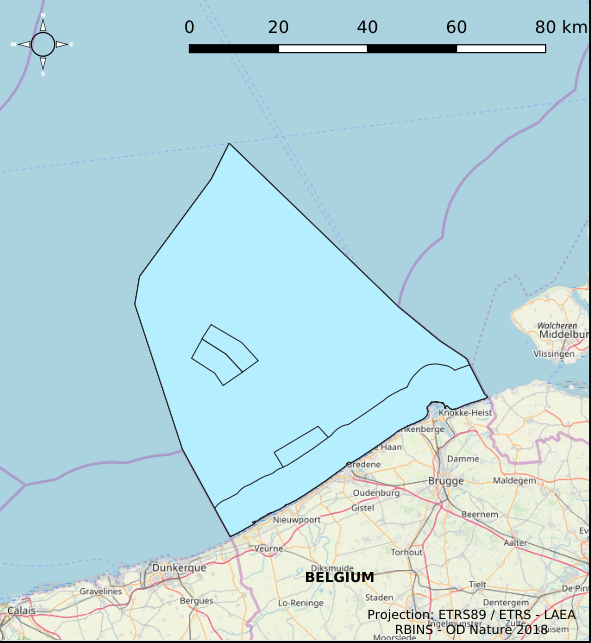
The Royal Decree of 22 May 2019 establishing a marine spatial plan defines 1 coastal protection experiments zone: Zone for coastal protection experiments (Art. 16§2). It replaces the 2014 Marine Spatial Plan, which is included for completeness. The Royal Decree of 20 March 2014 establishing a marine spatial plan defines in its Art. 12. §1 one zone for coastal protection experiments. This zone is made available digitally in the resource described by this metadata document. Please refer to the Belgian official gazette (\"Moniteur belge/Belgisch Staatsblad\") for official reference information.
-

This dataset is part of the 2018 Belgian submission for the Marine Strategy Framework Directive (MSFD) linked to descriptor 11, criterion 1. This dataset describes the impulsive noise generated during percussion pile emplacement for offshore wind farm construction and unexploded ordnance (UxO) explosions. Impulsive underwater sound (pressure) was measured during pile driving operations in Belgian waters, for different types of foundations (monopiles of different diameters, foundations of ducts with a smaller diameter) and hydraulic hammers with different energy powers. The results of measurements at Bligh Bank and Thornton Bank, with a resulting extrapolation of zero to peak noise level (Lz-p) at 750m and Sound Exposure Level (SEL) (no mitigation measures deployed), are presented (Norro et al., 2013).
-
This dataset is part of the 2018 Belgian submission for the Marine Strategy Framework Directive (MSFD) linked to descriptor 8, criterion 1. This dataset is part of the 2018 Belgian submission for the Marine Strategy Framework Directive (MSFD) linked to descriptor 8, criterion 1. This dataset contains the concentrations of priority substances (tributyltin, polycyclic aromatic hydrocarbons (PAHs) and polybrominated diphenylethers (PBDEs)) measured in the water column at three stations in the Belgian part of the North Sea between 2009 and 2014 (as reported in the frame of the WFD in 2016). In total, 45 different parameters are measured.
-
The Royal Decree of 22 May 2019 establishing a marine spatial plan defines 5 commercial and industrial zones: Zone A for commercial and industrial activities (Art. 23§1), Zone B for commercial and industrial activities (Art. 23§1), Zone C for commercial and industrial activities (Art. 23§1), Zone D for commercial and industrial activities (Art. 23§1), Zone E for commercial and industrial activities (Art. 23§1). Please refer to the Belgian official gazette (\"Moniteur belge/Belgisch Staatsblad\") for official reference information.
-

This dataset represents the exact location of active telecommunication cables (verified in 2010) installed in the Belgian Part of the North Sea.
-

This dataset represents the exact location of disused telecommunication cables installed in the Belgian Part of the North Sea.
-
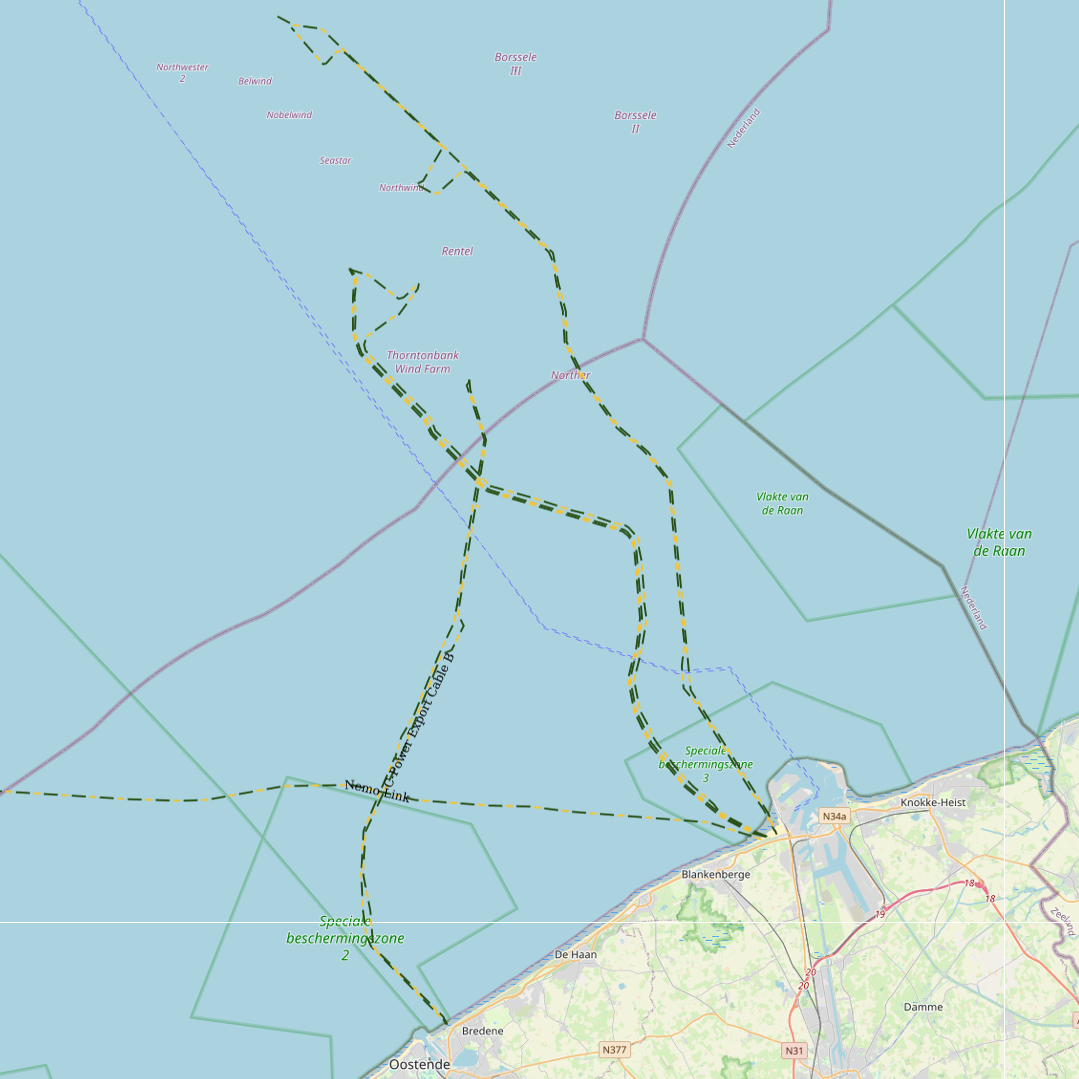
This dataset represents the exact location of electrical cables installed in the Belgian Part of the North Sea, including these for for the wind farms.
-
This dataset describes the location of the samples gathered for the Scientific research program DGL-JW (2021-15) managed bu the FPS Environment. Sampling started in 2004 and lasted until 2021.
-
The Royal Decree of 22 May 2019 establishing a marine spatial plan defines 7 fishery management zones: Professional fisheries (Art. 13), Passive fisheries area (Noordhinder Noord) (Art. 14§4), Passive fisheries area (Noordhinder Zuid) (Art. 14§4), Passive fisheries (Fairybank) (Art. 14§4), Search area 1 for fisheries techniques (Art. 6§1), Search area 2 for fisheries techniques (Art. 6§1), Search area 3 for fisheries techniques (Art. 6§1). It replaces the 2014 Marine Spatial Plan, which is included for completeness. The Royal Decree of 20 March 2014 establishing a marine spatial plan defines in its Art. 6, six fisheries management areas: Regular regime, Art. 6 § 1; Fisheries management area 1, Art. 6 § 1.1°; Fisheries management area 2, Art. 6 § 1.2°; Fisheries management area 3, Art. 6 § 1.3°; Fisheries management area 4, Art. 6 § 1.4°; Fisheries management area 5, Art. 6 § 3. These zones are made available digitally in the resource described by this metadata document. Please refer to the Belgian official gazette (\"Moniteur belge/Belgisch Staatsblad\") for official reference information.